And finally just a few days ago, Great Lakes mariner sent along this image of Ocean Tower loading a huge crane in Manitowoc for a tow to . . . Hawaii!
So the connection is this, Ocean Tower is currently in the Great Lakes, Gracie M will soon be, New York and Cape Henry already are here, and J. Arnold and Calusa Coast have been here. Keep your eyes on the lakes and you may see the latest ones here. I know there are others that have been here as well.
Many thanks to Great Lakes mariner; all others WVD.
Follow the sequence and name the location? There are some serious clues.
Here was the first installment of this series. Another previous post showed the superstructure of the barge back when it was its own self-propelled boat.
Here’s a significant clue to location.
I work on a vessel called Victory 1, and it was interesting to have two Victory-named vessels doing the Strait together.
More clues in the distance.
Sunrises are glorious on the water no matter when and where.
And the bridge in question here is the mighty Mac, our location.
First, because it is Memorial Day, I’d like to reshare this post from 2015 called A Time to Remember. The story at the end of the post about a former student of mine is emblematic of what this day is about. Gratitude to her and to all others and their stories gone too soon. *
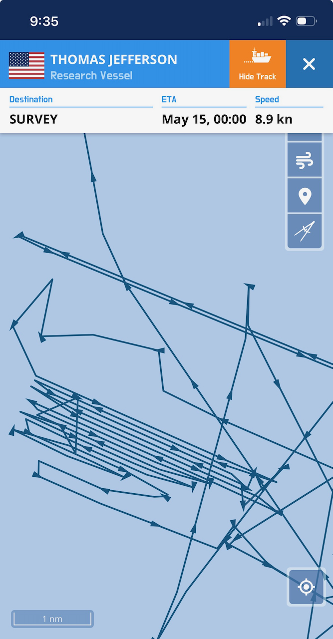
Accompanying the NOAA ship were two uncrewed vessels, referred to as DriXs, as explained here. Below is a DriX track from a few days back. These DriXs operate under conditions of “supervised autonomy,” i.e., a tender is nearby ready to intervene if needed. That might be an interesting job.
I was hoping to catch a glimpse of the DriXs when we arrived in Cleveland recently, but they were safely stowed.
Sister vessel to Thomas Jefferson is currently Seafreeze America, fishing vessel in the Bering Sea.
To the crew of the flotilla enclosed, happy mapping. I’d love to learn more about the NOAA aircraft doing LiDAR mapping.
All photos, any errors, WVD.
Attached below are some tracks from this morning, first zoomed out and then
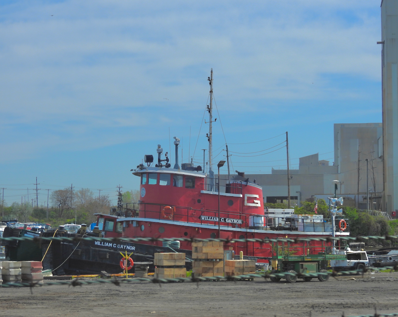
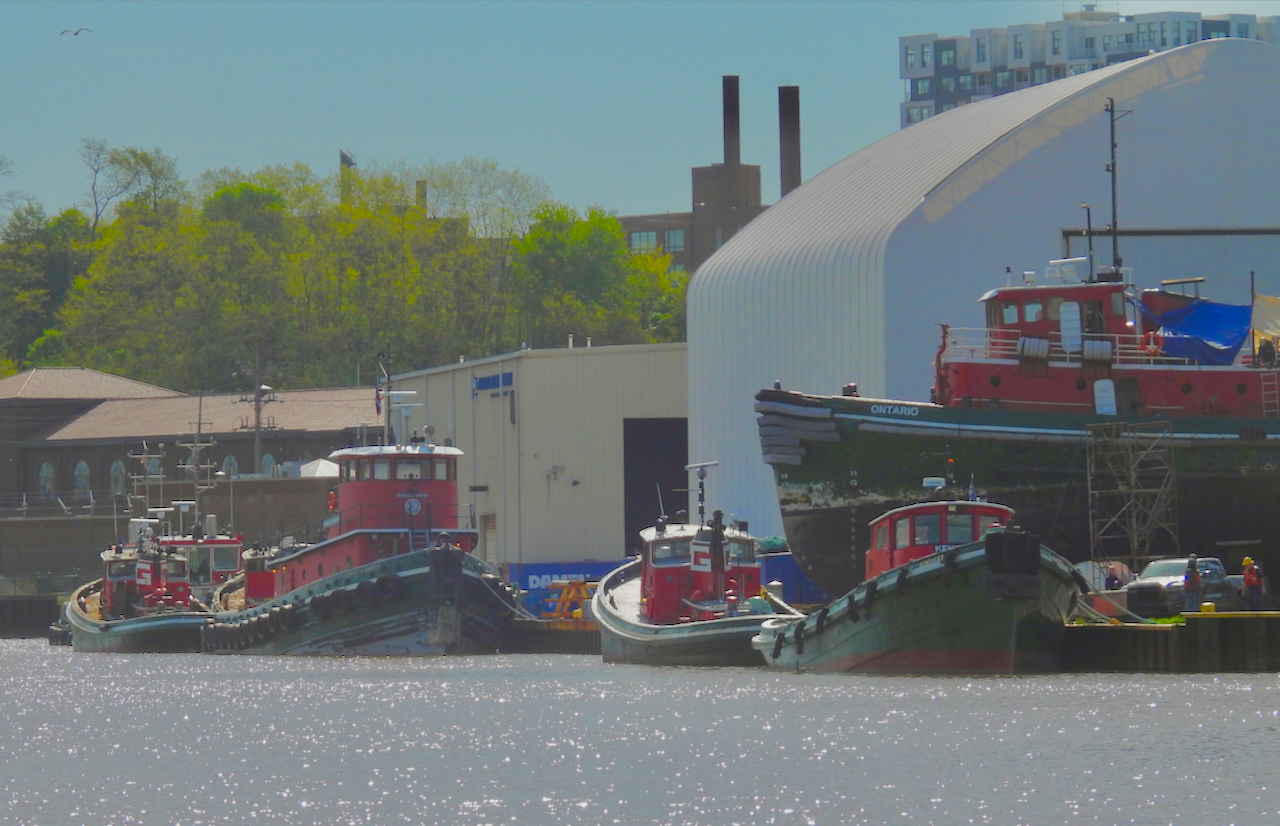
How many years of tugboats did I see the other day on the Old Cuyahoga behind Whiskey Island? Mental math might work. Start with Arkansas, built 1909.
Hawaii, newly raised from nearly a half year submerged as here . . . 1911. Wisconsin, 2020.
Tennesssee, 1911. William C. Gaynor, 1956.
Utah, 1913. Kansas, 1927.
Alaska, 1914.
Salvage Chief, ?. Iowa, 1915.
Muskie, 2011.
(l to r) Arizona [?] 1931. Kentucky, 1929. Ontario, 1964. unidentified WTGB. All others are already identified. Are you still doing the math?
(l to r) Kentucky, 1929. Donald J. Sarter, 1964. All others are already identified.
This one–as indicated above–I think is Arizona.
Now the math for the total ages?
Add in an approximate age for the WTBG and Salvage Chief, and you have a stunning more than 1200 years of vessels. This eclipses the 651 years of tugboats from multiple locations from a post back in 2010.
Dawn saw no sun. The USCG closed the St Marys in fact for the night fog. At dawn, we were allowed to proceed to the Soo. Mid-morning we passed within 500′ [my estimate] of James R. Barker, but
this is all we saw. It seems her “bark” has been remedied, unless a single-tone horn was the result of all this atmospheric moisture.
CBP was out.
Waiting at the approach wall to Poe, we next met Whitefish Bay.








Recent Comments