GFMC Contributions and Support to Earth Observation of Landscape Fires

Since the 1990s, GFMC has supported the development, test, calibration and validation of satellite sensors and photographic Earth Observation from Space Shuttle missions. Instrument tests included sensors for ground-based fire and fire-smoke detection systems.

The first steps in the 1990s and early 2000s

In 1994-1995, the GFMC (through its predecessor institution Fire Ecology Working Group) supported the German Aerospace Center (DLR) in carrying out the development project FIRES (FIre REcognition Satellite System).

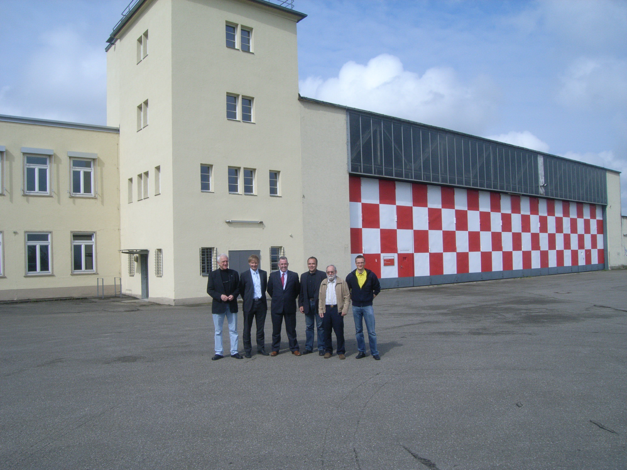
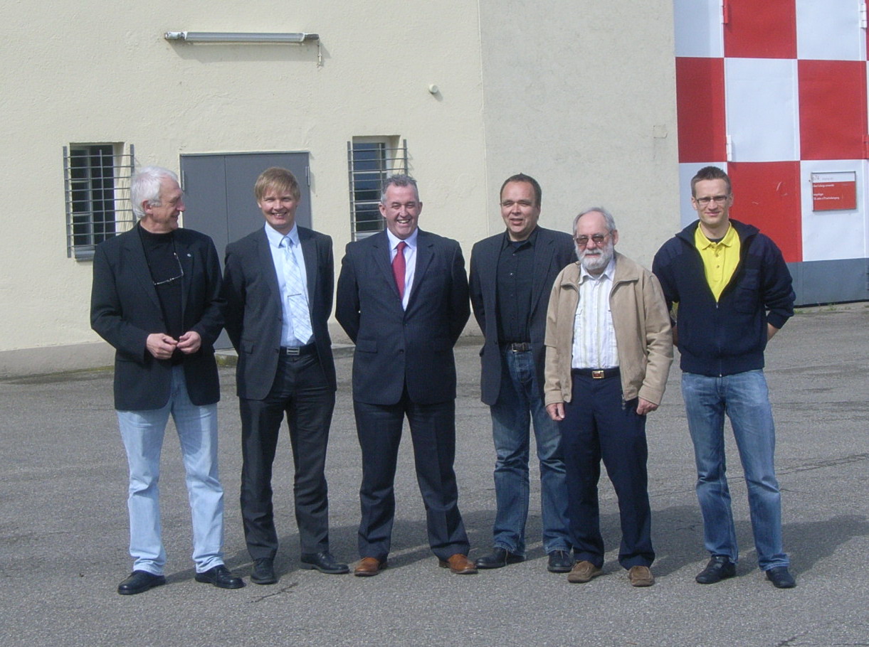
First tests for calibration and validation of sensors for space-based detection and characterization of landscape fires: Geometrically defined fires in open land and under the canopy of a pine forest in Breisach Forest District near Freiburg, Germany. The instruments were flown by a Do-228-212 of the German Aerospace Center operating out of Freiburg airfield in 1995. The successfully calibrated instrument was launched by the Mars 96 mission. However, the Russian spacecraft got lost. © Photos: GFMC archive.

Preparation and execution of a large forest fire experiment in Brandenburg State (Germany) in August 2001. Objective: Calibration of the satellite sensors, which were launched into orbit a few weeks later with the small satellite BIRD (Bispectral InfraRed Detection) and provided data until 2004 that enabled the further development of spaceborne observation instruments. Picture below left: Symbolic representation of the fire observation satellites BIROS (front) and TET-1 (back), which have been flying in the FireBIRD mission since 2016 in a mini-constellation on two spatially offset sun-synchronous orbits. This mission is described in the FireBIRD brochure. © Photos and satellite data: DLR and GFMC.

BIRD Small Satellite Mission Flyers:

In a follow-up series of experiments in Brandenburg State (Germany) in July 2003, the sensors on board of BIRD were tested again. A few days later, on 4 August 2003, information on the location and intensity of landscape fires was sent to the Portuguese authorities. This contributed to decision support for prioritizing fire suppression. © Photos and satellite data: DLR and GFMC.

Peat fires and coal seam fires in Indonesia are predominantly burning sub-surface. In May 2002, radiative power is detected by BIRD – as documented in GFMC Working Paper 2002/1 (cf. below – Briess et al. 1997). © Photos and satellite data: DLR and GFMC.

Automated fire smoke detection systems, which had been developed by DLR, were calibrated and improved during the Brandenburg State (Germany) in August 2001, followed by commercial application in Germany since then. © Photos: DLR and GFMC.

Follow-up: The FireSense Project

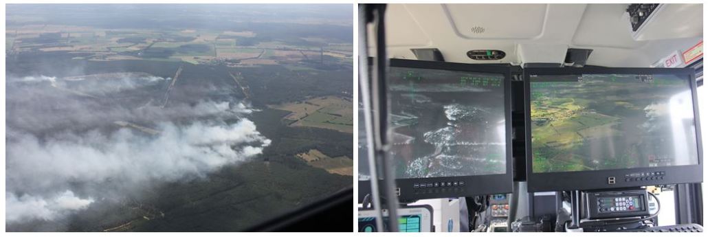
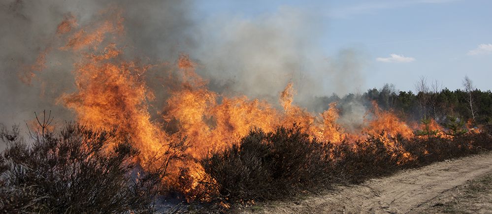
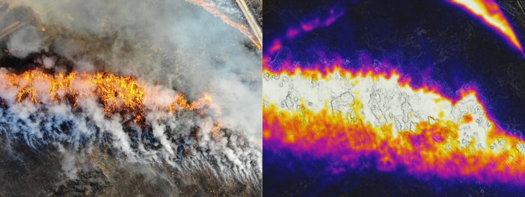
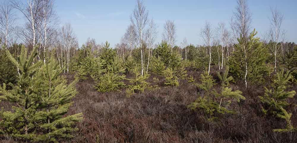
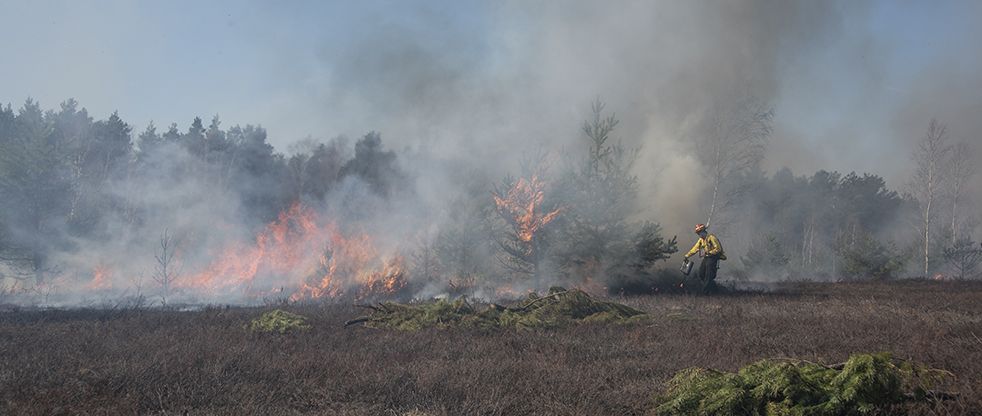
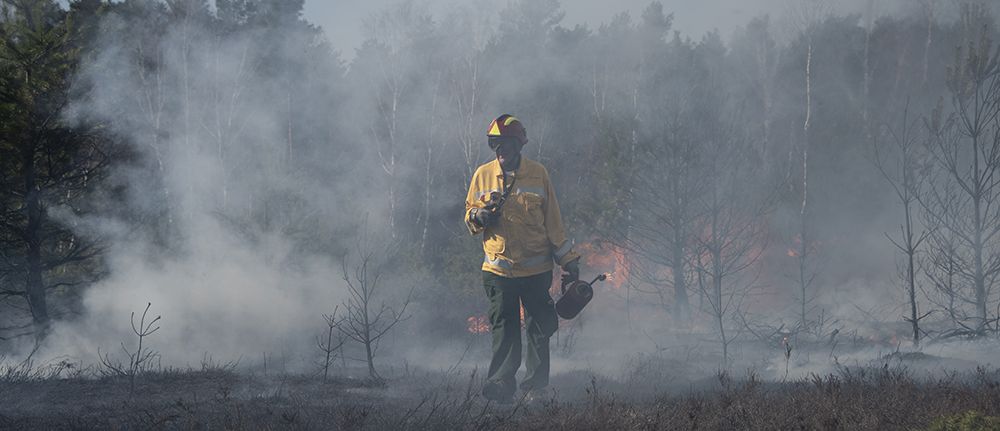
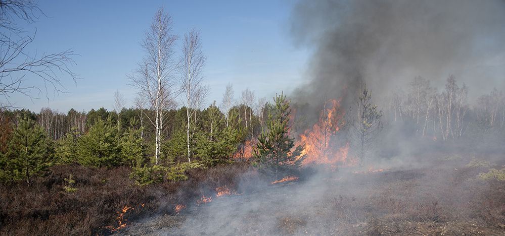
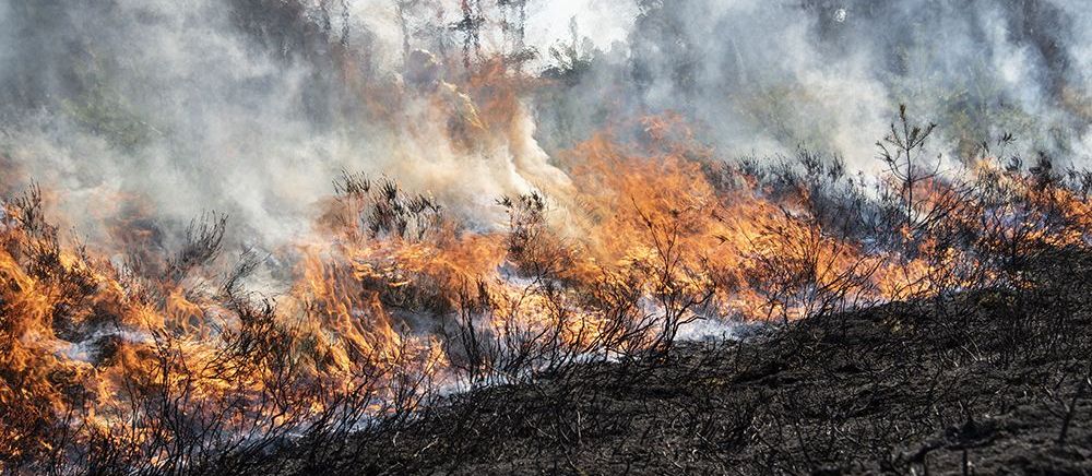
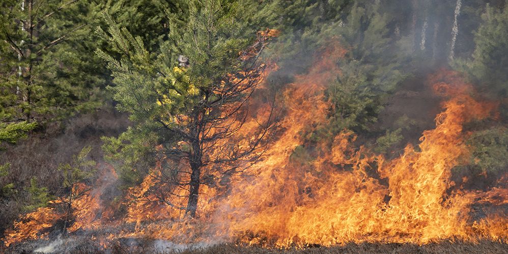
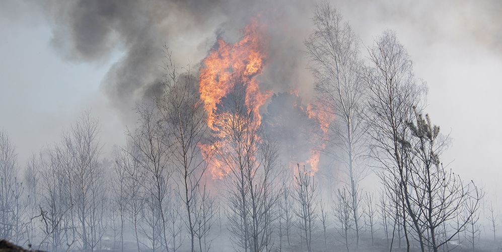
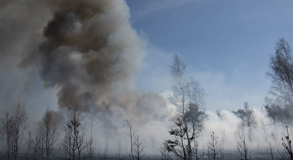
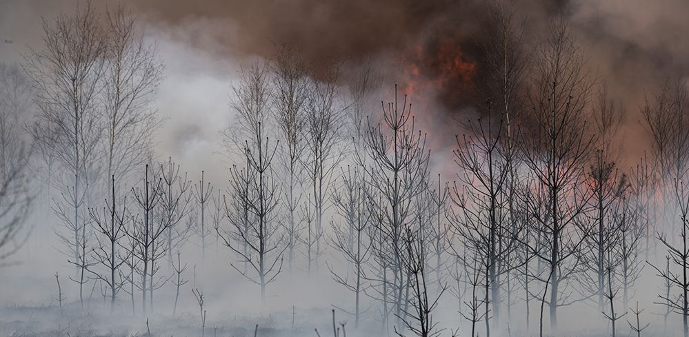
On 23 March 2019, a prescribed burn in Zschornoer Wald Nature Reserve was conducted on a conservation site belonging to the Deutschen Bundesstiftung Umwelt (DBU) Naturerbe (German Federal Environment Foundation – Natural Heritage) – a former military shooting range (aerial bombing range). The aim of the prescribed burn was to regenerate overaged Calluna vulgaris heather, implemented by the Federal Forest Service Enterprise Lausitz in cooperation with GFMC and partners. The prescribed burn operation was associated with the FireSense Experiment. The experiment included real-time observation and characterization of fire behavior – with simultaneous testing of ground-based, aerial (drone and aircraft) and satellite (multi-sensor) observation from space.

This experiment aimed at developing improved algorithms and products for the quantitative assessments of landscape fires and their emissions of trace gases and aerosols or validation and calibration of satellite by testing polar-orbiting satellites accompanied with fixed-wing aircraft and UAV. For details see GFMC FireSense website.

Global Observations of Forest Cover and Land-use Dynamics (GOFC–GOLD)

Between 2002 and 2016, the GFMC Director served as Co-Chair, Forest Fire Monitoring and Mapping Implementation Team, Global Observation of the Forest Cover (GOFC) program of the Global Terrestrial Observing System (GTOS) – alternate Co-Chair: Christopher O. Justice, University of Maryland, USA.

The GOFC/GOLD-Fire Mapping and Monitoring Theme is aimed at refining and articulating the international observation requirements and making the best possible use of fire products from the existing and future satellite observing systems, for fire management, policy decision-making and global change research.

  • Ahern, F., J.G. Goldammer, and C. Justice (eds.). 2001. Global and regional vegetation fire monitoring from space: Planning a coordinated international effort. SPB Academic Publishing bv, The Hague, The Netherlands, 302 p.Table of contents (PDF, 0.6 MB), Available now through Kugler Publications.

Websites and Online Information of DLR, GFMC and partners

GFMC and UN Office for Outer Space Affairs

The UN Office for Outer Space Affairs (UNOOSA) is the Secretariat for the United Nations Committee on the Peaceful Uses of Outer Space (COPUOS), a specialized committee of the UN General Assembly. The OOSA website provides background papers of the Third United Nations Conference on the Exploration and Peaceful Uses of Outer Space (UNISPACE III) which includes a report on Disaster Prediction, Warning and Mitigation (A/CONF.184/BP/2).

At the Forty-fourth session of the COPUOS Scientific and Technical Subcommittee (Vienna, 12-23 February 2007) a special session “Space-system-based disaster management support” included a presentation of GFMC:

GFMC Cooperation with NASA Space Shuttle Missions

Space Transportation System 60 (STS60) (Commander: Charles F. Bolden Jr.) was the first mission of the U.S. / Russian Shuttle-Mir Program, which carried Sergei K. Krikalev, the first Russian cosmonaut to fly aboard a Space Shuttle. The mission used NASA Space Shuttle Discovery, which lifted off from Launch Pad 39A on 3 February 1994, from Kennedy Space Center, Florida. The mission carried the Wake Shield Facility experiment and a SPACEHAB module, developed by SPACEHAB Inc., into orbit, and carried out a live bi-directional audio and downlink link-up with the cosmonauts aboard the Russian space station Mir.

For the first time in the Shuttle program, there was a true international partnership for Earth observations. The photographs taken by the mission aimed at monitoring changes around the world. After return of the mission on 11 February 1994, a Debriefing of the Crew took place at the Lyndon B. Johnson Space Center in Huston / Texas on 7 March 1994. GFMC took over the role of debriefing / interpreting STS-60 observations of forests and vegetation fires around the world.

STS-69 Crew photo dedicated to GFMC – clockwise from bottom left: Kenneth S. Reightler Jr., Franklin R. Chang-Díaz, Ronald M. Sega, Sergei K. Krikalev, N. Jan Davis, Charles F. Bolden Jr.

Crew Incentive Program / Debriefing of STS-60 Crew hosted by Captain (German Navy) Johann G. Goldammer, from left: Sergei K. Krikalev, Johann G. Goldammer, Charles F. Bolden Jr., Ronald M. Sega, with Earth greetings (beer keg) of Rothaus Brewery (Badische Staatsbrauerei Rothaus), Black Forest, Germany, that was spotted by STS-60 from space.

In following up STS-60, the preceding STS-61 mission (2-13 December 1993) was evaluated, resulting in the following publication:

STS-61 Crew photo dedicated to GFMC – Standing (from left): Richard O. Covey, Jeffrey A. Hoffman, Thomas Akers; seated (from left): Ken Bowersox, Kathryn C. Thornton, Story Musgrave and Claude Nicollier.

Related Publications of DLR, NASA, GFMC and Partners

Note: References are listed in time sequence, starting 1995:

B.J. Stocks, G.N. Korovin, A. Sukhinin, D.R. Cahoon, and J.G. Goldammer. 1995. Forest fire occurrence in Russia and Canada: Ground, aerial, and satellite measurements. IUFRO XX World Congress, Tampere, Finland, 6-12 August 1995. Abstract Vol., p.87.

Goldammer, J.G., J.L. Pfund, M.R. Helfert, K.P. Lulla, and STS-61 Mission Crew. 1996. Use of the Earth Observation System in the Space Shuttle Program for Research and Documentation of Global Vegetation Fires: A Case Study from Madagascar. In: Biomass burning and global change. Vol. I (J.S. Levine, ed.), 236-240. The MIT Press, Cambridge, MA.

Briess, K., H. Jahn, and H.P. Röser. 1997. BIRD – A DLR Small Satellite Mission for the Investigation of Vegetation Fires and Vegetation Condition. Int. Forest Fire News (IFFN) No. 16 (January 1997), 40-44.

Cahoon, D.R., B.J. Stocks, M.E. Alexander, B.A. Baum, and J.G. Goldammer. 2000. Wildland fire detection from space: theory and application. In: Biomass Burning and its Interrelationships with the Climate System (J. Innes et al., eds.), 151-169. Kluwer Acad. Publ.

Oertel, D., P. Haschberger, V. Tank, F. Schreier, B. Schimpf, B. Zhukov, K. Briess, H.-P. Röser, E. Lorenz, W. Skrbek, J.G. Goldammer, C. Tobehn, A. Ginati, and U. Christmann. 2000. Two dedicated spaceborne fire missions. In: Proc. Joint Fire Science Conference and Workshop, Boise, Idaho, USA, 15-17 June 1999, Vol. I, p. 254-261. Published by the University of Idaho and the International Association of Wildland Fire. 

Goldammer, J.G., and P. Frost. 2000. Towards a global system for forest fire monitoring and mapping: Breakout recommendations and priorities. In: Forest Fire Monitoring and Mapping: A Component of Global Observation of Forest Cover. Report of a Workshop (F. Ahern, J.-M. Grégoire, and C. Justice, eds.), 37-41. Eur. Comm. Joint Res. Center EUR 19588EN, 253 p.

Stocks, B.J., J.G. Goldammer, D.R. Cahoon, and P. Frost. 2000. Global fire monitoring: International policy requirements. In: Forest Fire Monitoring and Mapping: A Component of Global Observation of Forest Cover. Report of a Workshop (F. Ahern, J.-M. Grégoire, and C. Justice, eds.), 79-84. Eur. Comm. Joint Res. Center EUR 19588EN, 253 p.

Goldammer, J.G. 2000. Current state and future role of synthesis initiatives. In: Forest Fire Monitoring and Mapping: A Component of Global Observation of Forest Cover. Report of a Workshop (F. Ahern, J.-M. Grégoire, and C. Justice, eds.), 152-158. Eur. Comm. Joint Res. Center EUR 19588EN, 253 p.

Ahern, F., J.G. Goldammer, and C. Justice (eds.). 2001. Global and regional vegetation fire monitoring from space: Planning a coordinated international effort. SPB Academic Publishing bv, The Hague, The Netherlands, 302 p.

Goldammer, J.G. 2001. Current state of synthesis initiatives in global vegetation fire monitoring. In: Global and regional vegetation fire monitoring from space: Planning a coordinated international effort (F. Ahern, J.G. Goldammer, and C. Justice, eds.), 71-103. SPB Academic Publishing bv, The Hague, The Netherlands, 302 p.

Stocks, B.J., J.G. Goldammer, P.G.H. Frost, and D.R. Cahoon. 2001. Towards the development of an informed global policy on vegetation fires: what role for remote sensing? In: Global and regional vegetation fire monitoring from space: Planning a coordinated international effort (F. Ahern, J.G. Goldammer, and C. Justice, eds.), 35-46. SPB Academic Publishing bv, The Hague, The Netherlands, 302 p.

Goldammer, J.G. 2001. Current state of synthesis initiatives in global vegetation fire monitoring. In: Global and regional vegetation fire monitoring from space: Planning a coordinated international effort (F. Ahern, J.G. Goldammer, and C. Justice, eds.), 71-103. SPB Academic Publishing bv, The Hague, The Netherlands, 302 p.

Ahern, F.J., A.S. Belward, C.D. Elvidge, J.G. Goldammer, J.-M. Grégoire, C.O. Justice, J. Pereira, E.M. Prins, B.J. Stocks. 2001. The Fire Component of Global Observation of Forest Cover: a Plan of Action. In: Global and regional vegetation fire monitoring from space: Planning a coordinated international effort (F. Ahern, J.G. Goldammer, and C. Justice, eds.), 267-290. SPB Academic Publishing bv, The Hague, The Netherlands, 302 p.

Oertel, D., K. Briess, W. Halle, M. Neidhardt, E. Lorenz, R. Sandau, F. Schrandt, W. Skrbek, H. Venus, I. Walter, B. Zender, B. Zhukov, J.G. Goldammer, A.C. Held, M. Hille, and H. Brueggemann. 2002. Airborne forest fire mapping with an adaptive infrared sensor. Int. J. Remote Sensing 24, 3663-3682.

Zhukov, B., D. Oertel and J.G. Goldammer. 2002. BIRD Detection of Coal Seam Fires in East Kalimantan, Indonesia. Global Fire Monitoring Center (GFMC) Working Paper 1 / 2002 (PDF, 0.8 MB)

Goldammer, J.G., A.C. Held, M. Hille, K.-P. Wittich, E. Kuehrt, N. Koutsias, D. Oertel, K. Thonicke, and W. Cramer. 2003. Early Warning, Monitoring, Information Management and Simulation of Forest Fires: Results of the Research Cluster Forest Fire within the German Research Network for Disaster Reduction. 4. Forum Katastrophenvorsorge, Deutsches Komitee für Katastrophenvorsorge (DKKV), Extended Abstracts, 5-7. DKKV, Bonn.

Goldammer, J.G., A.C. Held, M. Hille, K-P. Wittich, E. Kuehrt, N. Koutsias, D. Oertel, K. Thonicke, and W. Cramer. 2004. Frühwarnung, Monitoring, Informationsmanagement und Simulation von Waldbrandgefahr. Teilprojekt A2. In: Risiken durch Naturgefahren in Deutschland. Abschlussbericht des BMBF-Verbundprojektes Deutsches Forschungsnetz Naturkatastrophen (DFNK) (B. Merz and H. Apel, eds.), 230-245. GeoForschungszentrum Potsdam, Scientific-Technical Report, 339 pp. <ISBN 1610-0956>

Huang, S., F. Siegert, J.G. Goldammer, and A.I. Sukhinin. 2009. Satellite-derived 2003 wildfires in southern Siberia and their potential influence on carbon sequestration. International Journal of Remote Sensing 30, 1479-1492. doi: 10.1080/01431160802541549. ISSN 0143-1161 print/ISSN 1366-5901.

Mallinis, G., I. Mitsopoulos, E. Beltran, and J.G. Goldammer. 2016. Assessing wildfire risk in cultural heritage properties using satellite imagery and spatially explicit fire simulations: The Case of Holy Mount Athos, Greece. Forests 7 (46), 1-19. ISSN 1999-4907. doi:10.3390/f7020046.

Myroniuk, V., S. Zibtsev, V. Bogomolov, J.G. Goldammer, O. Soshenskyi, V. Levchenko, M. Matsala. 2023. Combining Landsat time series and GEDI data for improved characterization of fuel types and canopy metrics in wildfire simulation. J. Env. Management 345, 118736. https://doi.org/10.1016/j.jenvman.2023.118736

Related

Since 2019, GFMC – in honorary role – supported the start-up OroraTech. The company, growing since then, offers the global wildfire intelligence solution, including risk assessment, early detection, real-time monitoring, and damage analysis with data from 20+ satellites (Status: December 2023).

OroraTech website: https://ororatech.com/wildfire-solution/

Cooperation between GFMC and CTIF

The International Association of Fire Services – the Comité Technique International de prévention et d’extinction du Feu (CTIF) founded in 1900 – is an organization of 39 Member States and 46 Associate Members. Since 2003, GFMC is associated with the Forest Fires Commission. Since 2018, GFMC is representing the German Federal Agency for Technical Relief (Bundesanstalt Technisches Hilfswerk – THW), Associate Member of CTIF since 2018, in the Commission. 

The CTIF Forest Fires Commission

Upon request of the CTIF General Secretariat in 2003, the GFMC facilitated the revival of the Forest Fires Commission. On 18 November 2003, at the occasion of the CTIF Congress hosted by Hungary in Budapest, Mr. Trond Rane, Sarpsborg Fire and Rescue Service, Norway, was appointed chair of the Forest Fires Commission. In addition to the online repository of documentation of the activities of the Commission (on the CTIF website from 2022 up to date and the Commission website hosted by the Croatian Fire Association from 2018 to 2022), the information provides a narrative of the phase of reactivation of the Commission in 2003 and after, with selected reports from activities conducted by GFMC or in which GFMC was involved directly or indirectly.

First Meeting 2003

In following-up the 2003 CTIF Congress, the first meeting of the reactivated Commission was held in Sarpsborg, Norway, 28-30 November 2003. Participants: GFMC and CTIF representatives of Norway, UK and Finland.

Subsequently, the second meeting, in conjunction with a first international meeting of the reactivated Commission, was planned to be held in Wels, Austria, on 09 June 2004. However, due to technical reasons this well-prepared meeting had to be cancelled.

Announcement of the CTIF Forest Fire Commission 2nd Meeting (PDF)

Third Meeting 2005

The 3rd meeting of the Commission was hosted by GFMC in Freiburg, Germany, on 28-30 January 2005. Subsequently. Mr. Mark Jones, Essex County Fire and Rescue Service, United Kingdom, accepted the position of chair of the Forest Fire Commission. In following up, the commission drafted a concept of training materials on forest fire management for the use of European Fire & Rescue Services and a European-wide survey of CTIF member Questionnaire to CTIF member nations and organizations on the subject of wildfires:

Development of the EuroFire Competency Standards and Training Materials

EuroFire was a two-year project implemented by GFMC, Rural Development Initiatives Ltd RDI and other partners, originally and primarily aimed to serve the CTIF Forest Fire Commission. The project was funded by the EU Leonardo da Vinci program and implemented between 2006 and December 2008. The project brought together partners with international expertise and experience in wildfire and prescribed fire research, management, and training to develop, evaluate, produce and distribute new European-wide, multi-lingual online training resources.

The EuroFire project researched and reviewed competency-based wildfire and prescribed fire training systems, including best practice examples from Europe and around the world. This research informed the production of competency-based basic training resources, for use in European countries. The EuroFire training resources have been specifically developed to support firefighting personnel, the land-based sector, sectoral organizations and education, and training institutions.

The EuroFire outputs include competency standards, training modules, illustrations and general guidance on a competency-based training system. Training resources that can be used by industry practitioners to update their knowledge, learn new skills or increase their understanding of basic wildfire and prescribed fire management techniques.

After termination of the active project in 2008, the GFMC continued involving partners in countries / regions to around the world to translate and apply the EuroFire materials for creating a basis of international cross-boundary interoperability in fire management. 15years later, in 2023, the EuroFire materials – originally developed in English language – have been translated for the use in Albania, Armenia, Azerbaijan, Bosnia and Herzegovina, Brazil (Portuguese), Croatia, France, Georgia, Germany, Greece, Indonesia, Iran, Korea, Latin America (all Spanish-speaking countries), Malaysia, Mongolia, Montenegro, North Macedonia, Nepal, Russia, Serbia, Thailand, Turkey, Ukraine and Vietnam. These 23 language versions are serving, among other, 88 English-speaking countries, 20 Spanish-speaking countries and 29 French-speaking countries.

Follow-up Commission Meetings with GFMC Involvement

CTIF Forest Fires Commission Meeting, Freiburg, Germany, 14 May 2010 

GFMC hosted the next meeting of the Commission at Freiburg Headquarters:

CTIF Forest Fire Commission members from the UK, Norway, Finland, Germany and Switzerland attended the meeting at GFMC.

Close up

Informal hand-over of chairmanship of the Commission from Mark Jones (right) to Havard Sormoen (left)

THW Germany joining CTIF

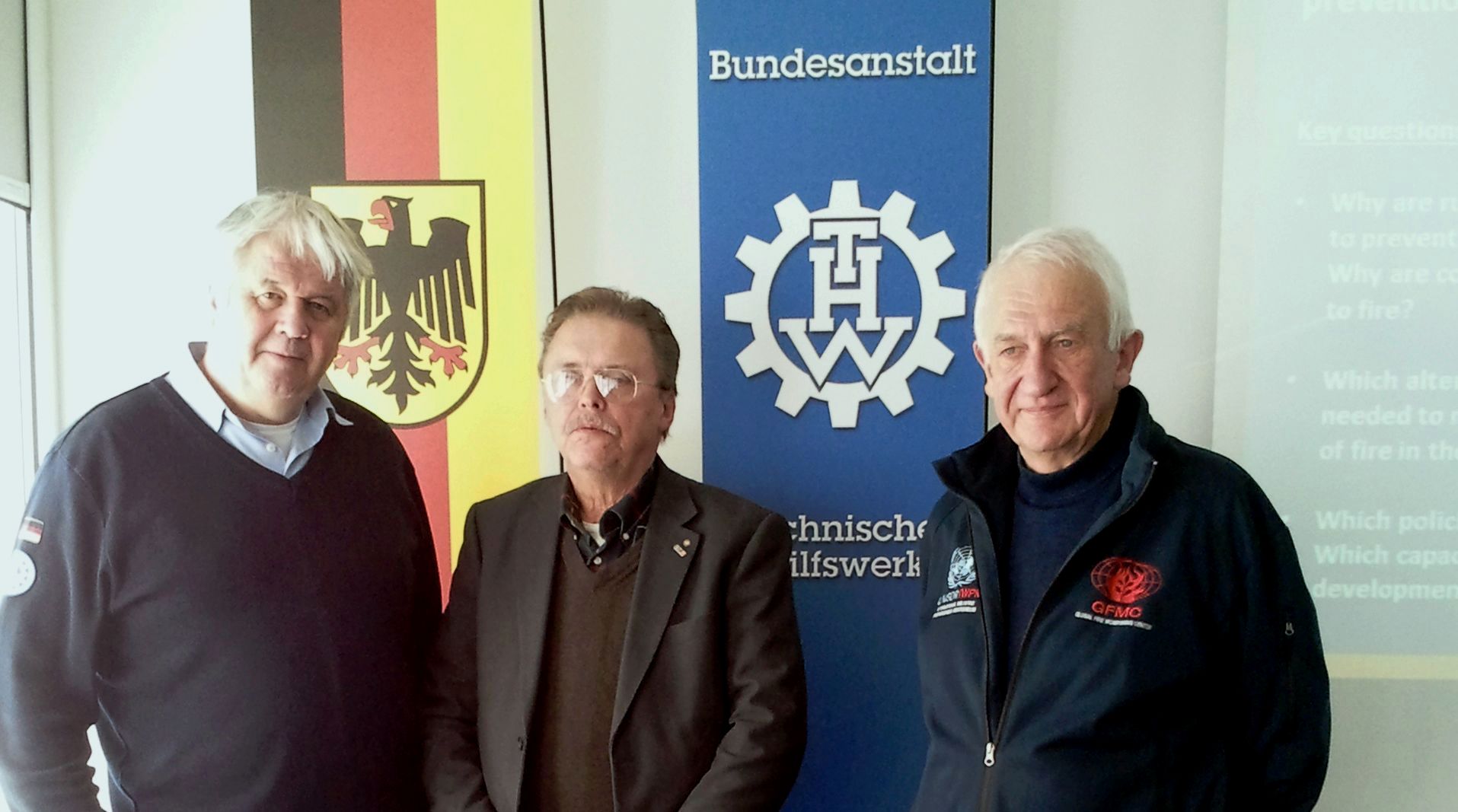
Meeting and consultations between the Presidents of the Federal German Agency for Technical Relief (Bundesanstalt Technisches Hilfswerk – THW), Albrecht Broemme, the International Association of Fire and Rescue Services (CTIF), Tore Eriksson, and GFMC (Johann Georg Goldammer). THW handing over letter of accession CTIF as Associated Member; Bundesanstalt Technisches Hilfswerk, Berlin, Germany.

From left: Albrecht Broemme, Tore Eriksson and Johann Georg Goldammer. Photo: THW

Follow-up Commission Meetings with GFMC Involvement

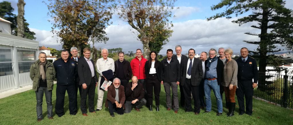
The 2019 Fall Meeting of the CTIF Forest Fire Commission, hosted by the Escola Nacional de Bombeiros (ENB), Portugal, was attended by representatives of 11 European countries. Photos: CTIF and ENB.

Aerial Firefighting Conference Europe 2023

After the first Aerial Firefighting Conference, held in Greece in 2008, the Tangent Link Aerial Firefighting series returned to Greece for 2023 (Athens, 16-17 October 2023). The conference was co-chaired by Zisoula Ntasiou (National Coordination Center for Operations and Crisis Management, Hellenic Fire Corps and Secretary of the CTIF Forest Fires Commission) and Johann Georg Goldammer (Director, GFMC). The conferences was also addressed by CTIF President Milan Dubravac.

Conference co-chairs Zisoula Ntasiou and Johann Georg Goldammer. © Photo: Tangent Link.

CTIF President Milan Dubravac addressing the conference. © Photo: Tangent Link.

TransParcNet Meeting 2023
“Fire and Water – How to deal with ‘natural’ disasters in transboundary parks cooperation?”

German-Dutch Nature Park Maas-Schwalm-Nette, 21-13 June 2023

Climate Change and its effects does not stop at borders. Whether it is dry summers leading to forest fires, or high amounts of rain in a small-time frame causing flooding, these disasters require a transnational approach. “Fire and water – how to deal with ‘natural’ disasters in transboundary cooperation?” was the topic of the 2023 TransParcNet meeting, the annual gathering of EUROPARC’s Transboundary Park Areas.

During the meeting, professionals discovered and discussed how Transboundary Protected Areas can work together to prevent and manage “natural” disasters. The programme included lectures, workshops, excursions and, of course, cultural evenings. The meeting was hosted by the German-Dutch Nature Park Maas-Schwalm-Nette (DE-NL), from 20 – 23 June 2023. Around 35 participants from 13 countries took part of the event.

The GFMC contribution addressed “Fire Management and Wildfire Risk Reduction in Cross-boundary Protected Areas” (presented by GFMC Chief J.G. Goldammer).

GFMC presentation on Fire Management and Wildfire Risk Reduction in Cross-boundary Protected Areas and discussion with representatives of transboundary parks from 13 European countries. Photo: TPC

Organização do Tratado de Cooperação Amazônica (OTCA)
Organización del Tratado de Cooperación Amazónica (OTCA)
Amazon Cooperation Treaty Organization (ACTO)

The Amazon Cooperation Treaty Organization (ACTO) is an intergovernmental organization formed by the eight Amazonian countries: Bolivia, Brazil, Colombia, Ecuador, Guyana, Peru, Suriname, and Venezuela, which signed the Amazon Cooperation Treaty (ACT), becoming the only socio-environmental block in Latin America. ACTO, with a broad vision of the South-South cooperation process, works in different dimensions within the framework of the implementation of the ACT: political-diplomatic, strategic, and technical, building synergies among governments, multilateral organizations, cooperation agencies, organized civil society, social movements, scientific community, productive sectors and society as a whole.

ACTO websites (Portuguese, Spanish and English):

One of the activities of ACTO is to foster cooperation in Integrated Fire Management (IFM) in the Amazon region.

The Amazon Summit 2023

During the opening of the Amazon Summit on 8 August 2023, the Secretary General of the Amazon Cooperation Treaty Organization (ACTO), Alexandra Moreira, said that the Belém Declaration is a bold commitment to the integral vision that has dealt with understanding the Amazon in its broadest dimension as a complex biome that requires management measures and that has faced a series of threats to its integrity. The President of Brazil, Luiz Inácio Lula da Silva, recalled that the first Summit was held in Belém in 1980, two years after the enactment of the Amazon Cooperation Treaty. “Based on this agreement, we founded the world’s first socio-environmental bloc, the Amazon Cooperation Treaty Organization (ACTO). Institutional strengthening will be based on science. The Amazon Regional Observatory, which gathers data on topics such as water resources, health, biodiversity and climate change, will provide inputs for our public policies and cooperation initiatives,” he said.

The Belém Declaration of 9 August 2023, stressed the intent to deepen cooperation and joint actions within the framework of the Memorandum of Understanding on Cooperation and Mutual Assistance for Integrated Wildland Fire Management between the State Parties, to address wildfires, through the development of policies, instruments, technical actions, and the use of innovation and technology, aimed at prevention, fire management, the promotion of alternatives to the use of fire in rural areas, firefighting and the strengthening of technical, scientific, institutional and community capacities (cf. para 52):

The Amazon Summit of 2023 was preceded by a number of thematic activities, to which GFMC contributed. In late 2023, the ACTO Secretariat and the Deutsche Gesellschaft für Internationale Zusammenarbeit (GIZ) are preparing a regional Integrated Fire Management project. GIZ held relevant consultations with ACTO secretariat and GFMC.

Preceding and follow-up events

International ACTO / OTCA Seminar
“Integrated Fire Management: Memorandum of Understanding on Cooperation and Mutual Assistance for Integrated Fire Management among ACTO / OTCA Member Countries”

On 12 August 2021, the International OTCA/ ACTO Seminar “Integrated Fire Management: Memorandum of Understanding on Cooperation and Mutual Assistance for Integrated Fire Management among ATC Member Countries” was held online.

Selected presentations of the webinar:

IWFC-7 Side Meeting between the Regional South America Wildland Fire Network, GFMC and ACTO

Campo Grande, Mato Grosso do Sul, Brazil, 31 October 2019

In following-up the public and political attention on use of fire in land use and land-use change (deforestation) in South America, notably in the Amazon region, the leadership of the Regional South America Wildland Fire Network, the Global Fire Monitoring Center (GFMC) (Secretariat of the Global Wildland Fire Network) and the ACTO Secretariat met at the occasion of IWFC-7.

ACTO Technical Report, describing the past and envisaged future involvement and cooperation in fire management in Amazonia:

Side meeting with Lara Steil, Co-Coordinator of the Regional South America Wildland Fire Network (left), Ambassodor Carlos Lazary Texeira, Director Ejecutivo SP/ACTO, and GFMC Director Johann Georg Goldammer, discussing the future cooperation agenda.
Photo: ACTO Secretariat.

Regional Workshop on Cooperation and Mutual Assistance to Fight Forest Fires in the Amazon Basin

Brasilia, 25 and 26 October 2012

In March 2012, during the second meeting of ACTO Ministers of the Environment, Member Countries committed to developing and sharing tools for the prevention, early detection, and timely control of forest fires.

From the Media

Relevant media reports are successively mirrored:


Kontrolliertes Brennen in Naturschutzgebieten mit Kampfmittelbelastung:
Naturschutzgebiet Heidehof-Golmberg, Brandenburg (2006-2014)

Beginnend mit ersten konzeptionellen Überlegungen im Jahr 2006 wurde 2009 ein Projekt auf den Weg gebracht, das sich in den Kernjahren 2010 bis 2014 als Vorhaben „Erprobung und Entwicklung von Methoden zur Heidepflege durch kontrolliertes Feuer auf munitionsbelasteten Flächen im NSG “Heidehof-Golmberg” (Landkreis Teltow-Fläming)“ umgesetzt wurde. Während der Kern des Projektes das sichere Feuer-Management auf kampfmittelbelasteten Standorten beinhaltete, die unter Naturschutz gestellt sind und nach dem EU-Recht einem Erhaltungsgebot unterliegen, so war absehbar, dass das Vorhaben auch Technologien und Verfahren zur Bekämpfung von Feuer auf kampfmittelbelasteten Standorten entwickeln würde. Diese wurden ab 2012 und vor allem 2018-2023 erfolgreich bei der Bekämpfung von Landschaftsbränden auf kampfmittelbelasteten Standorten in Brandenburg, Sachsen-Anhalt, Mecklenburg-Vorpommern und Hessen eingesetzt (s.u.). Projektergebnisse und weiterführende Literatur aus dem GFMC:

Brandenburg ist das Bundesland mit dem höchsten Anteil an Kampfmittelbelastung – ehemalige militärische Übungsflächen und Kampfgebiete des 2. Weltkriegs.


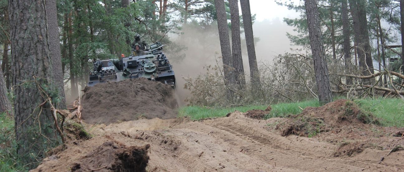
Absicherung des Kontrollierten Brennens durch den Löschpanzer SPOT-55 (11.000 l Löschmittel, volle Panzerung gegen unkontrollierte Detonationen). 


Zündpanzer auf Basis eines BMP-Kommandopanzers, mit ATV Drip Torch und Pyroshot Dragon zur sicheren Zündung von kontrollierten Bränden oder Gegenfeuern.

Entzündung eines Kontrollierten Feuers von Bord des BMP-Zündpanzers.

Monitoring des Brandverlaufs durch Drohnen und Fesselballon (links) und Absicherung der Brennfläche entlang kampfmittelberäumter Umfahrungswege der Flächen.

Kartierung der Brandflächen und Übergabe der freigelegten Munition an den Kampfmittelbeseitigungsdienst.

Projektergebnisse
Im September 2014 wurde durch das GFMC und in Zusammenarbeit mit der Verwaltung des Landkreises Teltow-Fläming ein Symposium mit dem Thema “Integriertes Feuer-Management in Brandenburg: Entwicklung von Konzepten für den Umgang mit Feuer und Vorbeugung von Feuerkatastrophen in den Natur- und Kulturlandschaften in Brandenburg” veranstaltet. Anlass war zum einen der erfolgreiche Abschluss des Forschungs- und Erprobungsvorhabens „Entwicklung von Methoden zur Heidepflege durch kontrolliertes Feuer auf munitionsbelasteten Flächen im NSG Heidehof-Golmberg (Landkreis Teltow-Fläming)“. Zum anderen wurde das Symposium vor dem Hintergrund zunehmender Herausforderungen der Bedrohung von Wäldern, Infrastruktur und Sicherheit der Bevölkerung durch Wildfeuer (Wald- und Flächenbrände) in Brandenburg abgehalten. Diese Herausforderungen bestehen darin, die verschiedenen sektoralen Verantwortungen und Herausforderungen mit dem Thema Wildfeuer (unkontrollierte und ungewollte Wald- und Flächenbränden) zusammen zu führen und damit rational und kompetent umzugehen. Die Zunahme der Herausforderungen ist vor allem vor der Kulisse des Wandels von Landnutzung, sozioökonomischer und demographischer Entwicklung und vor allem des absehbaren Klimawandels zu sehen. Nach Abstimmung mit allen beteiligten Projektpartnern und Behörden des Landes Brandenburg wurde der Landesregierung Brandenburg ein Bericht mit Anlagen vorgelegt:
Weitere Richtlinien des GFMC für Feuer-Management auf Standorten mit Belastung von Radioaktivität und Kampfmitteln
Eine Übersicht der Arbeiten des GFMC im Feuer-Management auf kontaminierten Standorten ist in englischer Sprache verfügbar:

Darunter finden folgende Richtlinien in mehreren Sprachen Anwendung.

Best practices and recommendations for wildfire suppression in contaminated areas, with focus on radioactive terrain:

Bekämpfung von Landschaftsbränden auf Standorten mit Kampfmittelbelastung:
Aufbau von Kompetenzen und Erfahrungen (2006-2019)

Nach den ersten Erfahrungen beim Einsatz von Löschpanzern auf munitionsbelasteten Standorten zwischen 2013 und 2017 wurde die Panzertechnik im Juni 2018 der Öffentlichkeit und den Behörden von Brandenburg erneut vorgestellt. Die Veranstaltung „Klimawandel und Waldbrand in Brandenburg: Steigenden Gefahren durch partnerschaftliche Lösungen Begegnen“ wurde durch den GFMC-Partner Dienstleistungen im Brand- und Katastrophenschutzfall (DiBuKa) und dem Kreisbrandmeister des Landkreises Prignitz am 23. Juni 2018 auf dem Truppenübungsplatz Havelberg durchgeführt. Weitere Beteiligung: Bundesanstalt Technisches Hilfswerk, Bundeswehr und Bundesforst.

Die Veranstaltung, die vom Landkreis Prignitz veranstaltet und vom GFMC moderiert wurde, führte das Einsatzspektrum der gepanzerten Löschtechnik auf kampfmittelbelasteten Standorten vor. Fotos: Anna Schulz, DiBuKa.

Hintergrundinformation und Online-Dokumentation der Veranstaltung

Einsatz der gepanzerten Löschtechnik in Mecklenburg-Vorpommern (Juli 2019)

Im Juli 2019 unterstützten das GFMC und DiBuKa die Landesregierung MV und den Landkreis Ludwigslust-Parchim bei der Bewältigung eines Feuers auf dem Gelände des ehemaligen Truppenübungsplatzes und Waffenarsenals Lübtheen. Die Unterstützung des Landkreises und der Landesregierung erfolgte „hands-on“ im Gelände und seitens der Medienarbeit in angemessener Zurückhaltung.
Einsatzplanung im Gelände und im Führungsstab:
Zusammenarbeit zwischen Landkreis Ludwigslust-Parchim, Landesregierung Mecklenburg-Vorpommern, Präsident THW, Staatsekretär BMEL, Bundesforst und GFMC und Partnerorganisationen (Lübtheen, 1.-4. Juli 2019).
Fotos: GFMC.

Einsatz der gepanzerten Löschtechnik in Sachsen und Berlin (Juli / August 2022)

Auf Anfrage des Landkreises Nordsachsen wurde das Team der DiBuKa, unterstützt vom GFMC, zwischen 27. und 31. Juli 2022 bei der Bekämpfung von Waldbränden auf kampfmittelbelasteten Standorten bei Torgau / Arzberg angefordert. Neben dem Löschpanzer Marder kamen Bergepanzer und Logistik von Löschwasserzufuhr zum Einsatz.

Am frühen Morgen des 4. August 2022 gab es auf dem Sprengplatz Grunewald einen Brand und mehrere große Explosionen. Ein Feuer griff auf den den Sprengplatz umgebenden Grunewald über. Zum Zeitpunkt des Brandes lagerten auf dem Sprengplatz rund 25 Tonnen Kampfmittel und Feuerwerkskörper. Der Einsatz des DiBuKa-Teams am gleichen Tag (bis zum 10.8.2022) erlaubte es, das Feuer innerhalb des Sicherheitsabstands von 1000 bzw. 500 Meter, die die ungeschützten Löschkräfte einhalten mussten, zu bekämpfen und die Brandfläche auf ca. 50 Hektar Wald zu begrenzen. Zerstört wurden auch das Munitions-Arbeitshaus, die Lagergebäude für Feuerwerkskörper und Sprengmittel und das Sprengstoff-Asservatenlager der Berliner Polizei. Durch die Explosionen wurden Munitionsteile weit in den Grunewald geschleudert. 

Nahaufnahme vom Löschpanzer “Marder” (Aufnahme von gepanzertem Fahrzeug aus, bei Arzberg, Landkreis Nordsachsen, 29. Juli 2022.


GFMC Repository of Prescribed Burning Sites in Temperate-Boreal Eurasia

In 2010, a database of the Eurasian Fire in Nature Conservation Network (EFNCN) was established to systematically compile and archive prescribed burning demonstration plots. This database also served the Fire Paradox project and includes a blank plot inventory form for reporting newly established observation sites:

The partners of GFMC had been encouraged to contribute to the database on prescribed burning demonstration plots by using the following plot inventory form:

List of prescribed burning demonstration plots

Note: Most inventory sheets have not been updated.

Finland

Germany

Mongolia

Poland

Russian Federation

Sweden

United Kingdom

Additional Information

First Bloemendaal Round Table

Fire Management in Nationaal Park Zuid Kennemerland and Adjoining Residential Areas

Bloemendaal, 27-28 February 2022

Introduction: Background and Objectives

The effects of climate change on increasing risk of wildfires in the Netherlands and neighboring countries of Central and Western Europe have become apparent. In April 2020, the largest wildfire in Dutch history burned around 800 hectares of vegetation in De Peel near Deurne and required the evacuation of 60 residents. Other wildfires occurred simultaneously nearby, notably near the Limburg village of Herkenbosch, where more than 4000 residents had to be evacuated.

The climate- and weather-related risk of wildfire hazard is aggravated by an increasing risk of accidental ignitions. The attractiveness of nature reserves – such as Nationaal Park Zuid Kennemerland and other conservation areas – to be visited for recreation and other leisure activities is bearing the risk of wildfire starts. Sustainable management of conservation areas is facing dilemmas in decision making: The multiple functions of conservation sites need to be addressed, e.g. safeguarding water catchment, biodiversity protection, terrestrial carbon storage and recreational services – and the risk of wildfires potentially endangering local residents.

The residents of Bloemendaal community, who are living at the edge of Nationaal Park Zuid Kennemerland, are interested to work with local and national authorities and other stakeholders to address an integrated approach of managing the fire risk in the National Park.

The Round Table addressed the concerns of wildfire safety of the residents –and equally safeguarding the multiple functions of Nationaal Park Zuid Kennemerland and will serve in particularly to

  • Exchange the state-of-the-art management of the national park
  • Analyze future-oriented management needs as determined by climate change and evolving requirements of society, with emphasis on wildfire prevention and safety
  • Establish a Task Force, which would address the issue of sustainable management of conservation areas and wildfire safety

27 February 2022: Field visit in Nationaal Park Zuid Kennemerland 

The field visit aimed at surveying:

  • Wildfire hazard of forest stands and open land habitats
  • Current management practices of the National Park
  • Wildfire threats to adjoining residential areas and critical infrastructure

The participants represented:

  • Global Fire Monitoring Center (GFMC)
  • Bloemendaal Municipality
  • PWN
  • Instituut Fysieke Veiligheid [IFV] (Institute for Physical Safety)
  • Veiligheidsregio Kennemerland
  • Bloemendaal residents

28 February 2022: First Round Table

The Round Table was convened at Bloemendaal City Hall, with participation of:

  • Fire Management in Nature Conservation Areas in Central-Western Europe: History, Current Practices and Future Challenges (GFMC)
  • Impressions of the Field Survey in the National Park Zuid Kennemerland on 27 February 2022(GFMC)
  • Climate adaptation in the dune area (PWN)
  • Fire management challenges in the Netherlands (IFV)
  • Discussion: The way ahead – Establishment of a Task Force / Living Lab

Selected visual impressions of wildfire hazard at Gaaienbos and adjoining residential areas – visual impressions gained at the field visit on 27 February 2022 – the perspective through the eyes of GFMC

Open pine stand with grass layer – highly flammable in winter and spring

More dense pine stand with grass layer and “fuel ladders” – high risk for development of a crown fire

More dense pine stand with grass layer and “fuel ladders” – additionally collapsed and ring-barked trees as natural habitats for endangered species – with higher fuel loads and potential risk of evolving spotting fires (flying embers). The large stems of trees would burn or glow slowly but contribute to an overall hazardous fuel arrangement.

The fence separating the nature reserve and the private residential lands and houses – with unbroken high wildfire risk

Open areas in Nationaal Park Zuid Kennemerland – candidates for fuelbreaks (buffer zones)

Vivid discussion at the Round Table concerning the management of the National Park and Gaaienbos Forest with regard to coordinated approaches of nature conservation, water catchment management and wildfire risk reduction

Historic landscape impressions of wildfire hazard

The following historic photographs and postcards have been identified by Layla Wijsmuller-Vafi and Frank Verveld. The photos reveal that since the early 20th Centurythe formerly open dune landscape has changed. Most houses and lookout points had been erected on bare or low-shrub vegetated dune sites. Following successive bush and tree encroachment, these sites nowadays are covered by forests and subject of high wildfire hazard.

The RESILPINE Project


Transformation of Pine Forests to a Close-to-Nature Forest Management in Ukraine and with special Consideration of Resilience to Fire and Climate Extremes such as Drought

Fire Research and Management Component:
A Cooperative Effort by the Regional Eastern Europe Fire Monitoring Center (REEFMC) and the Global Fire Monitoring Center (GFMC)

The project „Transformation of pine forests to a close-to nature forest management in Ukraine and with special consideration of resilience to fire and climate extremes such as drought” is a joint research and development project by the Eberswalde University for Sustainable Development (HNEE) (Eberswalde, Germany), the Global Fire Monitoring Center (GFMC) (Freiburg, Germany), the Ukrainian National Forestry University (UNFU) (Lviv, Ukraine) and the Regional Eastern Europe Fire Monitoring Center (REEFMC) (Kyiv, Ukraine). The project is coordinated by HNEE and funded by the German Federal Ministry for Food and Agriculture and (1 May 2020 to 30 April 2022).

The project is covering two main thematic fields (with various thematic elements):

  • Transformation of pine forests to a close-to nature forest management in Ukraine: the State Forestry Enterprise Lviv and the Training Forestry Enterprise Stradch – a model for close-to-nature and multifunctional forest management adapted to climate change
  • Ukrainian Forests and Climate Change: close-to-nature forest management and fire management solutions for increasing the resilience of pine forests in Ukraine to drought and wildfire

The first thematic field is developed by Eberswalde University for Sustainable Development, the Ukrainian National Forestry University and the Forest Enterprises Lviv and Stradch.

The second thematic field is conducted under the leadership of the Global Fire Monitoring Centre, together with Regional Eastern Europe Fire Monitoring Center (REEFMC) based the National University of Life and Environmental Sciences of Ukraine (NUBiP), Kyiv, Ukraine. Fire research and management components:

  • Wildfire risk reduction of pine forest by enrichment with broadleaved species
  • Wildfire hazard reduction of pine forest by applying nature-based integration of prescribed burning
  • Strategic planning and treatment of fuel breaks between forests, agricultural lands and settlements

25-28 October 2021
Field excursion of Research Cooperation Project “Transformation of Forests to Close-to-Nature Forest Management in Ukraine: Nature-based silvicultural and fire management methods for increasing the resilience of pine stands to drought and wildfire” (RESILPINE) with fire management components (see GFMC Calendar 21 April 2021). Field visits of the Ukrainian partners from Regional Eastern Europe Fire Monitoring Center (REEFMC), Institute of Forestry and Landscape-Park Management, National University of Life and Environmental Sciences of Ukraine (NULESU) at the former GFMC experimental areas in Nature Reserve Heidehof-Golmberg, wilderness area fire management in Jüterbog (Stiftung Naturlandschaften Brandenburg) and Forest District Baruth / Stülpe; Jüterbog, Treuenbrietzen, Teltow-Fläming County, Germany.

The REEFMC Team with the Directors of Forestry Enterprise Semenivsk and Oster Military Forestry Enterprise (Ukraine) in Heidehof-Golmberg Nature Reserve, with the local hosts of Foundation “Naturlandschaften Brandenburg” and Forest District Stuelpe. © Photo: REEFMC.

December 2021
Establishment of a RESILPINE permanent research plot at Oster Military Forestry Enterprise.

Enterprise Director Volodymyr Braiko showing the research plot billboard with description of the site and the research & development objectives. © Photo: REEFMC.

RESILPINE Sponsor

GFMC Prescribed Burning Operations for Restoration and Maintenance of Calluna vulgaris heathland ecosystem in Zschornoer Wald Nature Reserve (Germany), associated with the FireSense Experiment

23 March 2019


Introduction
The prescribed burn in Zschornoer Wald Nature Reserve was conducted on a conservation site belonging to the Deutschen Bundesstiftung Umwelt (DBU) Naturerbe (German Federal Environment Foundation – Natural Heritage) – a former military shooting range (aerial bombing range), which was cleared of unexploded ordnance (UXO). The aim of the prescribed burn was to regenerate overaged Calluna vulgaris heather, implemented by the Federal Forest Service Enterprise Lausitz in cooperation with GFMC and partners. The prescribed burn operation was associated with the FireSense Experiment. This experiment aimed at developing improved algorithms and products for the quantitative assessments of landscape fires and their emissions of trace gases and aerosols or validation and calibration of satellite by testing polar-orbiting satellites accompanied with fixed-wing aircraft and UAV.

Photo and Video Gallery of the FireSense Experiment

Source of photos: Dominic Jack, Max Planck Institute for Chemistry

Zschorno heath – threatened by overaging and tree invasion

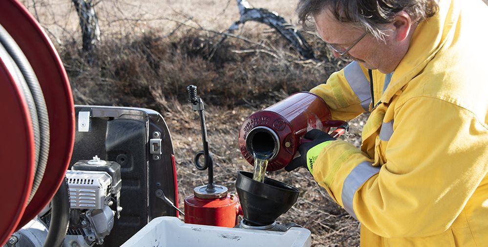
The first step for the preparation of the burn: Egbert Brunn, Federal Forest Service District Lausitz, filling the drip torch


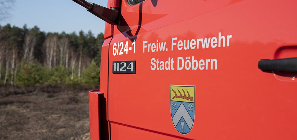
Doebern Voluntary Fire Service on standby

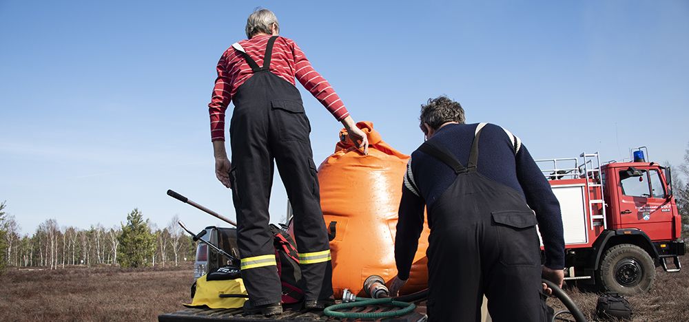
Doebern Voluntary Fire Service filling the slip-on unit water flexible water tanks

Ignition (1)

Ignition (2)

Ignition (3)

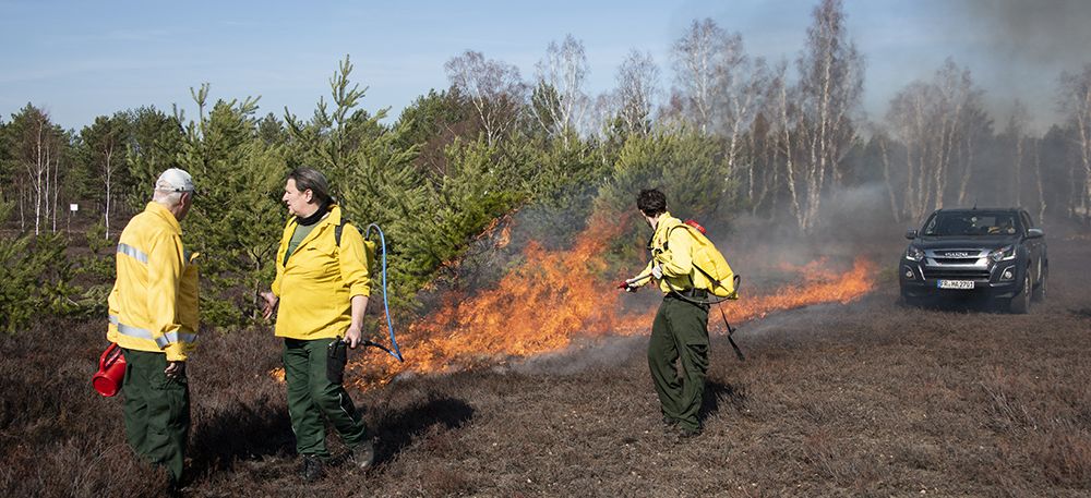
Initial spread of the fire

Setting the headfire


Build-up of fire intensity

Torching of individual large trees (1)

Torching of individual large trees (2)


Clean and successful burn – tree encroachment controlled

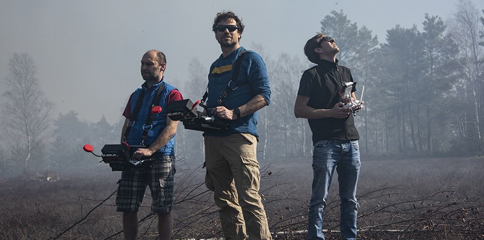
Monitoring of fires by UAVs


Monitoring of fires by UAVs: The UAV pilots

View from the UAV: Spread of the headfire at time of satellite overpass (1)

Fire depicted by MODIS Terra (1)

Fire depicted by MODIS Terra (2)

Video coverage by UAV

Source: Alexandro Caseiro and Johannes Kaiser, Max Planck Institute for Chemistry

  • FireSense UAV Visual and Infrared Bands Coverage I: Headfire stopped by backfire (mp4, 7.6 MB)
  • FireSense UAV Visual and Infrared Bands Coverage II: Building headfire line (mp4, 7.6 MB)
  • FireSense UAV Visual and Infrared Bands Coverage III: Headfire developing high-intensity run (mp4, 7.7 MB)

For more information on prescribed burning in heathland conservation and specifically on heathlands contaminated by UXO see:

GFMC Prescribed Burning Operations for Restoration and Maintenance of Calluna vulgaris Dune Heath Conservation Areas

Sylt Island and mainland of Schleswig-Holstein State (Germany) 2001-2018

17 July 2018
Prescribed burning operations on Calluna vulgaris heathlands on Sylt Island, in cooperation with Sylt Nature Conservancy (Naturschutzgemeinschaft Sylt) and County Conservation Administration (Untere Naturschutzbehörde Kreis Nordfriesland), following up the 2014+ burning programme on Sylt Island, Germany.

Nature Reserve Morsum Heath on Sylt Island during the prescribed burn for conservation of  Calluna vulgaris heath on 17 July 2018 (upper), immediately after the fire (middle) and an aerial view on 18 July 2018. Photos: Courtesy Naturschutzvereinigung Sylt (Sylt Nature Conservation  Association).

Morsum Heath post-fire impressions one year later (10 August 2019) showing successful result of the prescribed fire: Clean burn and mosaic patches of unburned depressions and tree-brush clusters (upper photo) and transition to the wet depression Southern fringe of the burned site. Photos: GFMC.

4-9 August 2014
Prescribed burning operation on Calluna vulgaris heathlands on Sylt Island, in cooperation with Sylt Nature Conservancy (Naturschutzgemeinschaft Sylt) and County Conservation Administration (Untere Naturschutzbehörde Kreis Nordfriesland); Sylt Island, Germany.

Prescribed fire set in Braderup Heath Conservation Area, 6 August 2014, for the Regeneration of overaged heathland.

Braderup Heath post-fire regeneration five years later (10 August 2019): Healthy regeneration of Calluna vulgaris heath

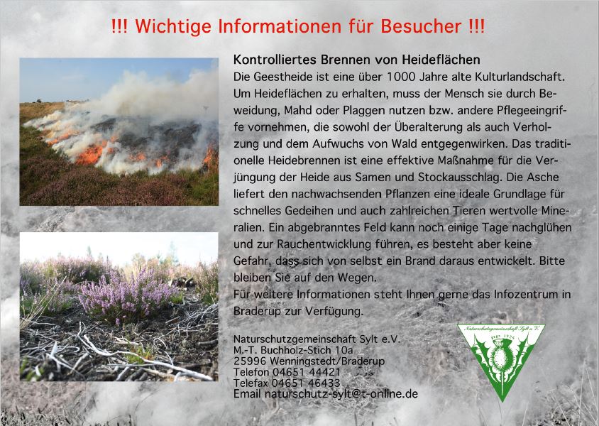
Public information set up along the fringes of the prescribed burn area.
Source:
Naturschutzgemeinschaft Sylt

30 June – 2 July 2006
Prescribed burning operations for conservation of atlantic Calluna heathlands in NW Germany; Luetjenholm, Schleswig-Holstein, Germany (in following-up the first prescribed burning operations in September 2002, March 2003 and July 2005)

GFMC prescribed burning operations in Atlantic Calluna heathlands
near Luetjenholm, NW Germany, in 2006. Photos: GFMC

6 September 2002
Prescribed burning operations for conservation of heathlands in NW Germany and fire behaviour and fire effects research; Braderup, Sylt Island, Schleswig-Holstein, Germany.

First GFMC prescribed burning operation in Atlantic Calluna dune heathlands
in Braderup Nature Reserve, Sylt Island, Germany, in 2002. Photo: GFMC

8 September 2001
On-site visit of GFMC for planning prescribed burning in dune heathland conservation on Sylt Island.